Friday, June 29, 2012

Waldo Canyon Fire

I decided not to memorialize with gratuitous pictures of destroyed homes.  But this was a week Colorado Springs will not soon forget.

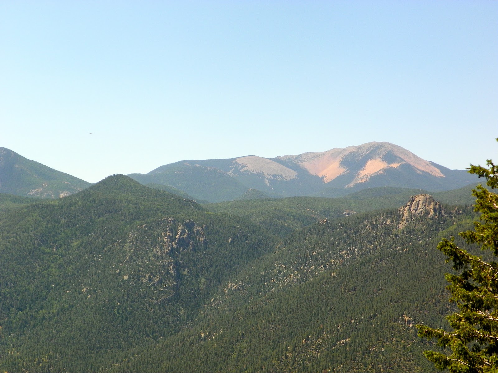
I drove up Ute Pass on 7/5/12.  The burn area visible from the road doesn't look too bad in most places yet - foliage still standing with wilted/browned leaves.  Fewer areas with scorched earth by the Waldo Canyon Trail.  Up by Pyramid Mountain, however, there is a bad spot that is very blackened and trees are gone or just black poles.

Found this satellite image of the burn area - darker brown is more burnt. Darker red is more 'green'.


This video shows timelapse of the fire from a distance, so does not show burning homes up close.
This video is from CSFD videographer showing the firefighters doing their job in a terrible situation on Tuesday night- does show some homes burning.


His Supplication in Asking for Water during a Drought (Supplication - 19)


O God,
water us with rain,
unfold upon us Thy mercy
through Thy copious rain
from the driven clouds,
so that Thy goodly earth may grow
on all horizons!

Show kindness to Thy servants
through the ripening of the fruit,
revive Thy land
through the blossoming of the flowers,
and let Thy angels - the noble scribes - be witness
to a beneficial watering from Thee,
lasting in its abundance,
plenty in its flow,
heavy, quick, soon,

through which Thou revivest what has vanished,
bringest forth what is coming,
and providest plentiful foods,
through heaped up, wholesome, productive clouds,
in reverberating layers,
the rain's downpour
not without cease,
the lightning's flashes
not without fruit!

O God,
give us water
through rain,
helping, productive, fertilizing,
widespread, plentiful, abundant,
bringing back the risen,
restoring the broken!

O God,
give us water with a watering through which Thou wilt
make the stone hills pour,
fill the cisterns,
flood the rivers,
make the trees grow,
bring down prices in all the lands,
invigorate the beasts and the creatures,
perfect for us the agreeable things of provision,
make grow for us the fields,
let flow for us the teats,
and add for us strength to our strength!

O God,
make not the cloud's shadow over us a burning wind,
allow not its coldness to be cutting,
let not its pouring down upon us be a stoning,
and make not its waters for us bitter! 
O God,
bless Muhammad and his Household
and provide us with the blessings of the heavens and the earth!
Thou art powerful over everything 

Monday, June 18, 2012

Mt. Pyramid in Cascade 6/18/12

Very hot today at 97 degrees along with a late start, but great views of Pikes Peak on this hike.  We started in Cascade and hiked up to Rampart Range Road, via some dirt roads past potential development lots to the star on the hillside, and then onto a fairly faint trail to the Rampart Range Road. It was a very steep climb a few places along the way - this one felt like one of the more physical hikes we've had even though it was not the longest distance.  Trekking poles came in handy. The trail seems to be very little used, probably largely unknown due to development below - some of the lower trails showing on the Pikes Peak Atlas are gone or are roads now.  Good adventure.  The trail was very loose gravel at the steepest part and we worried about the descent, but there was actually enough gravel to "dig in" so that it went much better than expected.  This was just pre-fire, so I do not know if the trail exists anymore but I believe it is likely 'closed'.
View southeast down Ute Pass.

That little round circle middle right is the "half-way" point where we exit the dirt road and take off on the little-used trail.  We need to go about this far from there again to the road.

Nice views of Almagre from here.

After some steep gravel stuff much more of the Peak comes into view.


Caught just a bit of the Cog train (top right).

Bear sign.

Human sign - looks old.

It was an accomplishment to make it to Rampart Range Road.  We rested here for a bit.

Smoke from the Springer Fire between Eleven-mile and Lake George, on the way back down.


Beautiful blue sky.

Saturday, June 16, 2012

St. Mary's Falls 6/16/12

Jenny Chapman's annual. :)  Very pleasant hike in the North Cheyenne Canyon area - I think technically you end up in Buffalo Creek Canyon or something like that.  Fairly athletic hike without being out of range for most healthy active adults.  A fair number of people set out on this hike without finishing it though - either they don't realize how long it is and don't allot enough time (I did that the first time - went in March when there was snow on the ground and needed more time due to it), or they get tired from the fairly persistent steepness on the way up.  But, people who hike regularly will not find this hike unusually difficult - it is more the people who kind of randomly decide to head out to the Canyon for the day without a specific plan who are likely to be turned around.


Tuesday, June 12, 2012

Chataqua Mountain via Palmer Reservoirs

Hiking the summit of Chataqua Mountain isn't quite what we set out to do, but it worked out very fortuitously into a nice loop right back to the parking lot.  Got to sign a log at the summit.  Steep all around, but nice views.  The trail to summit Chataqua is one of the only trails the Pikes Peak Atlas misses - which contributed to our wrong turn - we thought we were turning toward Limbaugh Canyon since the Chataqua summit trail wasn't on the map.  Palmer Lake is a nice place to hike and there are more trails to explore here someday.